Elk Hunt in Idaho
(Sunday October 9-Friday 14, 2011)
We're late start starting the drive to Elk City, Idaho. The plan is to meet up with other family members going Elk hunting. We aren't hunters but enjoy the adventure with everyone. As we head towards Donner summit, the visible moon moon reminds us that there aren't many hours of daylight left. But we figure it's better to be late than never make the effort.

Lots of highway repairs being done on the way to Donner Lake.


A reminder of our great Blackrock Desert experience earlier this year.

We're traveling on highway 95. As Mel put it..."Doesn't this road ever end?" It just keeps going on and on. I took many photos to pass the time and show just how wondrous and beautiful America is. These are only a few from many scenes.


Colorful remnants from earth's violent past.


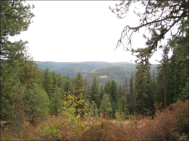
Jordan Valley?


The highway winds on and on through small towns, ranches and lonely remnants from the past nestled in river carved valley's beneath majestic mountains.


Sometimes rocks, and other times corn fields line both sides of the road.


Many beautiful rivers.


Outside Parma is the Tree Top Ranch. As we drove past we caught a glimpse of what resembled a castle, but I think it was the barn that even has a waterfall nearby. Owners Larry and Marianne Williams raise thoroughbred horses. Together with her husband, Marianne has played a vital role in the support of collegiate athletics at Boise State University, and has served on the Bronco Athletic Association Board of Directors. Marianne has played an integral role in the growth and success of the various businesses that she and Larry have founded, including Tree Top Ranches and Idaho Timber Corporation.


This is Weiser. Eventually it was dark and I hate looking for a place to stop for the night. My former truck driver husband doesn't see anything wrong with it. Strange, narrow, winding roads are difficult to negotiate while looking for a place to pull over. We finally did alongside a river. The river spilling over the rocks was like a lullaby...and then it started raining so it was even better.


Following breakfast we were on our way following the Salmon River winding through towering mountains. It's hard to capture the beauty and majesty of such sights on film, but I can't help trying.


He's getting a little wet.


Ahead is the right turn off to White Bird, but we'll be climbing the steep grade up 95.


The little historic town of White Bird below us. It's in Idaho County, Idaho. The population was 106 at the 2000 census. Both the town and the adjacent White Bird Hill are named after the Indian Chief White Bird. At the southwest corner of the Camas Prairie, White Bird is near the Salmon River crossing point for the Lewis and Clark expedition. It is also the location of the 1877 Battle of White Bird Canyon, which was the first fight of the Nez Perce War and a significant defeat of the U.S. Army. Chief White Bird was a leader of the tribe. The summit of White Bird Hill is 2700 feet (823 m) above the city, via U.S. Highway 95. We're ascending the steep grade on 95 (on the left side overlooking the town), headed for Grangeville. There we'll switch to highway 14 leading to Elk City. As we gaze across the beautiful rugged canyon little do we dream that before long we would be coming back to the town from the other side.


This is where the Battle of White Bird Canyon was fought on June 17, 1877 in Idaho Territory, the western part of present-day Idaho County, Idaho, southwest of the city of Grangeville. It was the beginning of the war with the Nez Perce nation, and represented a significant defeat of the U.S. Army.
The prelude to war was the original treaty between the U.S. government and the Nez Perce, signed in 1855, establishing a reservation that acknowledged the ancestral homelands of the Nez Perce. In 1860, the discovery of gold on the Nez Perce Indian Reservation brought an uncontrolled flood of miners and settlers into the area. Despite numerous treaty violations, the Nez Perce remained peaceful. However, in 1863, responding to pressures to make land available to settlers, the U.S. government forced another treaty on the Nez Perce, reducing the size of the reservation by 90%. The leaders of the bands living outside the new reservation refused to sign the "steal treaty" and continued to live outside the new reservation boundaries until the spring of 1877. In May 1877, under threat of force from the U.S. Army, the non-treaty bands moved from their homelands towards the new reservation. The Wal-lam-wat-kain (Wallowa) Band, led by Chief Joseph (left), lost a large number of horses and cattle crossing rivers swollen with spring runoff. The bands eventually gathered at Tepahlewam, the traditional camping ground on the Camas Prairie at Tolo Lake to enjoy the last days of their traditional lifestyle. It was an emotional rendezvous, and many of the people disagreed with the course of peace and compliance.
On June 14, three young men, including Wahlitits entered the Salmon River area to seek revenge for the 1875 murder of Wahlitits' father, Tipyahlanah Siskan. The success of their mission roused the desire for vengeance among other warriors and resulted in more attacks on settlers in the area. As least 18 settlers were killed in skirmishes with the Nez Perce. Settlers sent messengers from the community of Mt Idaho to Fort Lapwai describing these events and demanding assistance from the military.
The Nez Perce at Tepahlewam were aware that General O. O. Howard would be preparing to send his soldiers against them. By June 16, the bands had moved to the defensible canyons of Lahmotta. That night, sentinels reported the approach of General Howard's soldiers from the north. After much deliberation, it was decided that they would stay at Lahmotta, make an effort to avoid war, but fight if they were forced to do so. At daybreak on June 17, approximately 60 to 70 Nez Perce warriors were in various stages of preparation for the expected attack. Many had left camp and positioned themselves in the ravines and hills surrounding their camp in White Bird Canyon. Six Nez Perce warriors waited with a white flag to discuss a truce with the approaching army. One hundred and six mounted soldiers from Companies F & H of the U.S. 1st Cavalry Regiment, commanded by Captain David Perry, along with eleven civilian volunteers from Mt. Idaho, descended into White Bird Canyon along a wagon road from the north east. An advance party, consisting of Lieutenant Edward Theller, Trumpeter John Jones, a few Nez Perce scouts employed by the Lapwai Agency, seven soldiers from Company F and Authur "Ad" Chapman made first contact with the truce party.
Yellow Wolf later gave this account: "Five warriors, led by Wettiwetti Houlis...had been sent out from the other [west] side of the valley as a peace party to meet the soldiers. These warriors had instructions from the chiefs not to fire unless fired upon. Of course they carried a white flag. Peace might be made without fighting." For reasons never fully explained, the volunteers that were traveling with Captain Perry fired at the Nez Perce. The Nez Perce returned fire, and the battle began. Advancing to the northwest ridge line, Lieutenant Theller deployed his men. Trumpeter Jones was ordered to signal a call to arms. Before Jones could finish his trumpet call, he was shot from his horse by Otstotpoo, positioned over 300 yards (270 m) away on a knoll to the east. Captain Perry's Company F dismounted and formed a skirmish line on the east side of the Theller's advance party, while Company H, led by Captain Trimble, deployed a mounted line on the west side of Theller's position. The volunteers attempted to position themselves on the north ridge line.
Captain Perry believed his left flank would be protected from attack by the volunteers on the ridge, but couldn't see their activities. Shortly after leaving the main column, the volunteers led by George Shearer, encountered warriors hidden in the bushes below and to the east. Shearer ordered his men to dismount and fight on foot. A few obeyed, but the majority retreated back towards Mt Idaho. Seeking protection in Perry's command, Shearer led his few remaining men to the top of the ridgeline, but found himself between the attack on Perry's left flank led by Two Moons and the sniping fire from warriors protecting the White Bird camp.
Perry ordered an attacking charge on the warriors on his left flank. He ordered a dropping of carbines, and drawing of pistols for the anticipated charge. He ordered Trumpeter Daly to sound the charge but Daly had lost his trumpet. Perry's lines of communications to his troops was lost with the trumpet. Perry ordered a dismount and subordinates ordered a Number fours which caused every fourth man to take the reins of the horses and led them out of the line of fire. The remaining soldiers of Company F then advanced on foot to the ridge line.
Meanwhile, Company H attempted to deploy at five yard intervals along the ridge while still mounted. This proved disastrous, because the inexperienced troop were not able to shoot from the backs of their terrified horses. Captain Perry, riding back and forth between the two companies, saw the volunteers retreating up the canyon. Several events then occurred that sealed the fate of the cavalry in the Battle of White Bird. Perry's left flank and Trimble's right flank were compromised. Meanwhile, Captain Trimble dispatched Sergeant Michael McCarthy and six men to the highest point above the battle. to protect his rear and right flank. Perry also noticed the rock cliffs and sent soldiers to assist McCarthy.
Seeing further collapse of his flank, Perry sent word down the line to withdraw to McCarthy's position, about 300 yards to the north. The confusion and casualties caused Perry's order to be misinterpreted as a general retreat by Company F. When Company H saw the urgent retreat of Company F, it joined the flight and left McCarthy and his men stranded.Sensing victory...Ollokot's mounted warriors chased the retreating soldiers. McCarthy, aware that he was cut off from the main detachment, galloped towards the retreating troops. Captain Trimble ordered McCarthy to return to his position in an attempt to take high ground. Trimble could not muster any supporting troops for McCarthy's position. Lieutenant Parnell saw McCarthy's predicament and rallied ten men from Company H. However, only McCarthy and another soldier were able to be rescued.
The retreat followed two general routes. Lieutenant Parnell and Lieutenant Trimble led their men in an attempted to retrace their morning approach towards the White Bird camp. Under fire they turned up a box canyon, ran out of ammunition and were killed by the warriors. Captain Perry and Captain Trimble retreated to the northwest up steep ridge lines. They reached the Camas Prairie beyond the ridge line and were able to regroup at Johnson's Ranch. Within minutes, Nez Perce warriors pressed the attack and the survivors retreated under fire towards Mt Idaho where they were rescued by fresh volunteers. By mid-morning, 32 U.S. Cavalry soldiers had been killed and 2 had been wounded, while 2 volunteers had also been wounded in the opening of the battle. In contrast, only three Nez Perce warriors had been wounded. Approximately 63 carbines, many pistols, and hundreds of rounds of ammunition were picked up off the battlefield by Nez Perce warriors. These weapons greatly enhanced the Nez Perce arsenal for the remaining months of the war. The battle in White Bird Canyon was a lopsided victory for the Nez Perce. Outnumbered two to one and fighting uphill with inferior weapons, the Nez Perce used their intuitive fighting skills to win the first battle of the Nez Perce war.In October 1877, about ninety adults and a great number of children led by White Bird arrived with some three hundred head of horses at Sitting Bull's camp in Saskatchewan. White Bird and his family settled in Pincher Creek, Alberta, area to live out their lives. The war chief never returned to the United States, choosing to stay in Canada at Pincher Creek. White Bird was murdered on March 6, 1892, by a fellow Nez Percé named Charley Hasenahamahkikt.
The town of White Bird, Idaho, and the adjacent White Bird Hill in Idaho County are named for Chief White Bird (left). Like many of his people, he was a Dreamer, a follower of the teachings of Smohalla, the Wanapam shaman and prophet. Alongside Chief Joseph, White Bird directed the 1877 withdrawal from eastern Oregon into Montana and ahead toward the Canadian border during the Nez Perce War. White Bird and Joseph led the Nez Percé Indians until October 1877, when General Nelson Miles of the U.S. Army attacked them at Snake Creek at the Battle of Bear Paw, south of Havre, Montana. Following a five-day fight, Joseph and many of the fatigued band acknowledged a cessation of hostilities, surrendered to Miles, and became prisoners of war. White Bird refused to relinquish, and left on the night of October 5. He effectively slipped through enemy lines with over a hundred of the band. In October 1877, about ninety adults and a great number of children led by White Bird arrived with some three hundred head of horses at Sitting Bull's camp in Saskatchewan. White Bird and his family settled in Pincher Creek, Alberta, area to live out their lives. The war chief never returned to the United States, choosing to stay in Canada at Pincher Creek. White Bird was murdered on March 6, 1892, by a fellow Nez Percé named Charley Hasenahamahkikt.
Hin-mah-too-yah-lat-kekt, popularly known as Chief Joseph, or Young Joseph (March 3, 1840 – September 21, 1904) was the leader of the Wal-lam-wat-kain (Wallowa) band of Nez Perce during General Oliver O. Howard's attempt to forcibly remove his band and the other "non-treaty" Nez Perce to a reservation in Idaho. For his principled resistance to the removal, he became renowned as a humanitarian and peacemaker. (Chief Joseph and his family at right.)
Joseph was born Hinmuuttu-yalatlat (alternatively Hinmaton-Yalaktit or Hin-mah-too-yah-lat-kekt, Nez Perce: "Thunder Rolling Down the Mountain") in the Wallowa Valley of northeastern Oregon. He was known as Young Joseph during his youth because his father, Tuekakas,was baptized with the same Christian name, later becoming known as "Old Joseph" or "Joseph the Elder."
While initially hospitable to the region's newcomers, Joseph the Elder grew wary when settlers wanted more Indian lands. Tensions grew as the settlers appropriated traditional Indian lands for farming and grazing livestock. Isaac Stevens, governor of the Washington Territory, organized a council to designate separate areas for natives and settlers in 1855. Joseph the Elder and the other Nez Perce chiefs signed a treaty with the United States establishing a Nez Perce reservation encompassing 7.7 million acres (31,000 km²) in present-day Idaho, Washington, and Oregon. The 1855 reservation maintained much of the traditional Nez Perce lands, including Joseph's Wallowa Valley. An influx of new settlers caused by a gold rush led the government to call a second council in 1863. Government commissioners asked the Nez Perce to accept a new, much smaller reservation of 780,000 acres (3,200 km2) centered around the village of Lapwai in Idaho, and excluding the Wallowa Valley. In exchange, they were promised financial rewards and schools and a hospital for the reservation. Lawyer and one of his allied chiefs signed the treaty on behalf of the Nez Perce Nation, but Joseph the Elder and several other chiefs were opposed to selling their lands, and did not sign. Their refusal to sign caused a rift between the "non-treaty" and "treaty" bands of Nez Perce. The "treaty" Nez Perce moved within the new Idaho reservation's boundaries, while the "non-treaty" Nez Perce remained on their lands. Joseph the Elder demarcated Wallowa land with a series of poles, proclaiming, "Inside this boundary all our people were born. It circles the graves of our fathers, and we will never give up these graves to any man."
Joseph the Younger succeeded his father as leader of the Wallowa band in 1871. Before his death, the latter counseled his son: "My son, my body is returning to my mother earth, and my spirit is going very soon to see the Great Spirit Chief. When I am gone, think of your country. You are the chief of these people. They look to you to guide them. Always remember that your father never sold his country. You must stop your ears whenever you are asked to sign a treaty selling your home. A few years more and white men will be all around you. They have their eyes on this land. My son, never forget my dying words. This country holds your father's body. Never sell the bones of your father and your mother."Joseph commented, "I clasped my father's hand and promised to do as he asked. A man who would not defend his father's grave is worse than a wild beast."
The non-treaty Nez Perce suffered many injustices at the hands of settlers and prospectors, but out of fear of reprisal from the militarily superior Americans, Joseph never allowed any violence against them, instead making many concessions to them in hopes of securing peace. In 1873, Joseph negotiated with the federal government to ensure his people could stay on their land in the Wallowa Valley. But in 1877, the government reversed its policy, and Army General Oliver Howard threatened to attack if the Wallowa band did not relocate to the Idaho Reservation with the other Nez Perce. Joseph reluctantly agreed. Before the outbreak of hostilities, General Howard held a council to try to convince Joseph and his people to relocate. Joseph finished his address to the General, which focused on human equality, by expressing his "[disbelief that] the Great Spirit Chief gave one kind of men the right to tell another kind of men what they must do." Howard reacted angrily, interpreting the statement as a challenge to his authority. When Toohoolhoolzote protested, he was jailed for five days. The day following the council, Joseph, White Bird, and Looking Glass all accompanied General Howard to look at different areas. Howard offered them a plot of land that was inhabited by Whites and Native Americans, promising to clear them out. Joseph and his chieftains refused, adhering to their tribal tradition of not taking what did not belong to them.
Unable to find any suitable uninhabited land on the reservation, Howard informed Joseph that his people had thirty days to collect their livestock and move to the reservation. Joseph pleaded for more time, but Howard told him that he would consider their presence in the Wallowa Valley beyond the thirty-day mark an act of war. Returning home, Joseph called a council among his people. At the council, he spoke on behalf of peace, preferring to abandon his father's grave over war. Toohoolhoolzote, insulted by his incarceration, advocated war. The Wallowa band began making preparations for the long journey, meeting first with other bands at Rocky Canyon. At this council too, many leaders urged war, while Joseph argued in favor of peace. While the council was underway, a young man whose father had been killed rode up and announced that he and several other young men had already killed four white settlers. Still hoping to avoid further bloodshed, Joseph and other non-treaty Nez Perce leaders began moving people away from Idaho.
With 2,000 U.S. soldiers in pursuit, over 800 Nez Perce fled east, hoping to take refuge with the Crow nation, but when the Crow refused to grant them asylum, the Nez Perce went north in an attempt to reach Canada. For over three months, the Nez Perce outmaneuvered and battled their pursuers traveling 1,300 miles (2,100 km) across Oregon, Washington, Idaho, Wyoming, and Montana. General Howard, leading the opposing cavalry, was impressed with the skill with which the Nez Perce fought, using advance and rear guards, skirmish lines, and field fortifications. Finally, after a devastating five-day battle during freezing weather conditions with no food or blankets, with the major war leaders dead, Joseph formally surrendered to General Nelson Appleton Miles on October 5, 1877 in the Bear Paw Mountains of the Montana Territory, less than 40 miles (60 km) south of Canada in a place close to the present-day Chinook in Blaine County. The battle is remembered in popular history by the words attributed to Joseph at the formal surrender: "Tell General Howard I know his heart. What he told me before, I have it in my heart. I am tired of fighting. Our chiefs are killed; Looking Glass is dead, Too-hul-hul-sote is dead. The old men are all dead. It is the young men who say yes or no. He who led on the young men is dead. It is cold, and we have no blankets; the little children are freezing to death. My people, some of them, have run away to the hills, and have no blankets, no food. No one knows where they are—perhaps freezing to death. I want to have time to look for my children, and see how many of them I can find. Maybe I shall find them among the dead. Hear me, my chiefs! I am tired; my heart is sick and sad. From where the sun now stands, I will fight no more forever."(I remember these words well. My step-father Val Baima wrote Chief Joseph's story for a newspaper many years ago. Some time later I was horse back riding with an elderly lady who told me how grateful she was for him writing about her ancestor.)
Joseph's fame did him little good. By the time Joseph surrendered, more than 200 of his followers had died. Their plight, however, did not end. Although he had negotiated a safe return home for his people, General William Sherman forced Joseph and about four hundred followers to be taken on unheated rail cars to Fort Leavenworth in eastern Kansas to be held in a prisoner of war campsite for eight months. Toward the end of the following summer the surviving Nez Perce were taken by rail to a reservation in the Indian Territory (now Oklahoma) for ten years. Many of them died of epidemic diseases while there. Finally they were returned to a reservation around Kooskia, Idaho. In 1879 Chief Joseph went to Washington, D.C. to meet with President Rutherford B. Hayes and plead the case of his people. Finally, in 1885, Chief Joseph and his followers were allowed to return to the Pacific Northwest, although many, including Chief Joseph, were taken to the Colville Indian Reservation far from both the rest of their people in Idaho and their homeland in the Wallowa Valley.Joseph continued to lead his band of Wallowa for another 25 years, at times coming into conflict with the leaders of 11 other tribes living on the reservation. Chief Moses of the Sinkiuse-Columbia in particular resented having to cede a portion of his people's lands to Joseph's people, who had "made war on the Great Father." The relocated Nez Perce made few enemies in their new home and even kept friendly relations with their white neighbors. One early Oregon settler recalled his encounter with Chief Joseph, "Why I got lost once, an' I came right on [Chief Joseph's] camp before I knowed it . . . 't was night, 'n' I was kind o' creepin' along cautious, an' the first thing I knew there was an Injun had me on each side, an' they jest marched me up to Jo's tent, to know what they should do with me ... Well; 'n' they gave me all I could eat, 'n' a guide to show me my way, next day, 'n' I could n't make Jo nor any of 'em take one cent. I had a kind o' comforter o' red yarn, I wore rund my neck; an' at last I got Jo to take that, jest as a kind o' momento."
In his last years Joseph spoke eloquently against the injustice of United States policy toward his people and held out the hope that America's promise of freedom and equality might one day be fulfilled for Native Americans as well. An indomitable voice of conscience for the West, he died in 1904, still in exile from his homeland, according to his doctor "of a broken heart." The Chief Joseph band of Nez Perce Indians who still live on the Colville Reservation bear his name in tribute to their prestigious leader. Joseph died in September 1904 and was buried in Nespelem, Washington, the site where many of his tribe's members still live. Chief Joseph Dam, the nation's second largest hydroelectric power plant, was named after him. (You can find the entire story and references in Wikipedia) To me this story symbolizes the natural tendencies, and behavior of human nature that causes so much pain and suffering on earth.
Okay there was a thirty minute traffic delay just above the battle field. Enough time to read the history. Now we're on the summit and as we descend the other side We notice large black strips across the landscape. Apparently, that's the color of the exposed soil after it's plowed.
Grangeville, Idaho where we fuel up, continue on 95 and then take Highway 14 to Elk City. They told Mel it was a steep winding road down to the river junction where we turn onto 14.
You can see the river and highway below.
This is the junction where we double back. We just came down the upper highway in the photo.
We decided not to go to Elk City (next photo) because we were slow getting there, and the Bunch would be at Red River Hot Springs.
Before long we saw this weird contraption in the river. Naturally, I had to go down the trail to see what it is.
It turned out to be a Juvenile Fish Trap for Chinook Salmon and Steelhead trout during their emigration to the Pacific Ocean. After 1 to three years in the ocean the mature fish will return to their birthplace to spawn. Interesting, but not mentioned here...the Salmon will die following the spawn, but the Steelhead trout will continue to spawn another three or four years.
The government manages the Elk and wildlife in this area. We hadn't gone very far when here comes the Bunch from the other direction. They had hunted and enjoyed the hot spring pool waiting for us, and decided they needed to look for us. The forest was too dense in the area around Elk City and Red River for good hunting. Hunters who live in the area buy hunting and fishing licenses for everything, and since the Elk feed on their ranches all summer...all they have to do is step outside and take their pick. Anyway, we turned around and hopefully followed Tim, Margie and Brent to greener pastures.
Yeah...they made it through.
That bull's in the same position we'd noticed not long ago.
We went back Grangeville via another highway. I'd been wondering how Tim could have made that sharp turn from 14 to 95 on our previous route out of town. Heading back up the canyon we found a rest area and spent the night there. Yep, after breakfast we fired it up and what do you know...The sun's peaking over the mountain, and we're crossing that bridge again from the opposite direction.
Brent's the explorer checking out places to go...where they might be able to maneuver to hunt.
We're turning left to check out the river canyon. The weather's pretty nice, and lots of people are fishing.
A trailer house came across the bridge from the other direction. Word is that the road is narrow, and if you meet someone there aren't any big turnouts. Not a good place to take the big RV, so Tim decides to turn around here.
Back seat driver Maggie wonders what's next...
We're back to 95 enjoying the sun and river while waiting for a decision from headquarters. It's decided that we continue up 95 and turn right before the overpass and go down through White Bird.
Outside White Bird the road turns right to Grangeville. It winds up the other side of the canyon through a few scattered cattle ranches with huge stashes of baled hay.
Open range with a cattle guard on the left and open (but closable gate) on the right.
And here they come, following their wise lead cow.
We reach a fork in the road. Twin Cabins is five miles to the left, and Grangeville 23. They decide to unload and find a good place to camp. Not far left they found one.
If you look closely at this burnt stump you'll see a tiny chipmunk on the top.
Maggies looking for the chipmunk.
Maggie gave up back seat driving for the front seat.
These hunters have been coming to this campsite for 26 years.
Everyone decides to head back for home...No elk, but it was interesting and fun.
Tim couldn't resist treating everyone to a delicious Huckleberry piece of pie.
It's time to find a place for the night when we reach Lovelock, Nevada. Lovelock is a city in western Nevada that is the county seat of Pershing County, the location of a prison, and the namesake of the area's Cold War gunnery range. Bet you didn't know that in 2008, O.J. Simpson began a minimum nine year prison sentence at the Lovelock Correctional Center. Signs along the highway warn drivers to not pick up hitch hikers.
Driving through around we came across the 2 Stiffs Selling Gas Chevron Service Station sign. For the middle of nowhere it's always been unique. Lovelock is between Reno and Winnemucca heading across Nevada. We were thinking about it earlier, and finding it was like taking a trip back in time. The internet shows a collector's post card "1940's Two Stiffs selling Gas Chevron Service station Lovelock Nevada NV Motel" selling for $6. Travel through this area began over 150 years ago. Lovelock's grassy and well-watered valley made it a stopping point for travelers bound for California. The railroad came in 1868, and further contributed to the growth of the town. In 1984 to prevent flooding of Lovelock, a channel from the Humboldt Sink to the Carson Sink was cut by the Nevada Department of Transportation. When Mel's family moved to Nevada City in 1927 they traveled on a dirt road that turned to mud in some areas. Luckily, they were able to drive around those cars that were stuck. Because of bad weather conditions, when they reached Truckee they left the car there and took the the train over the summit.
We wound up spending the night in a rest area at a major freeway intersection. The traffic was terrific and noisy because it was fairly early. Later things calmed down. Next morning it was easier to see entire picture why....
The sage along the highway looks like it's blooming.
Many mines and manufacturing rock material and minerals.
Reno and the home stretch ahead...
Stopped at the rest area on 20 overlooking Steephollow for a few moments.
We passed over a dozen of these on their way to work.
And finally we're back to Nevada City. It's been quite a rut breaking adventure through interesting, beautiful places with our dear ones. Sort of an endurance test for a couple of old fogies.